Our pick of 15 winter walks in the Peak District & Derbyshire and hikes should blow the cobwebs away. The rolling moors and tough climbs can offer some lovely days out and a break away from it all. Is your favourite listed?
Let’s take a closer look at the best winter walks in the Peak District and Derbyshire
From quiet woodland to exposed moorland, these walks suit a range of experience levels. Check the forecast and daylight before setting out, choose a route for your group’s ability, and take warm, waterproof layers and suitable footwear. For hill walks, carry a map and compass and know how to use them; snow and ice can make routes much more demanding.
Eyam & Stoney Middleton

⭐️ Best for: History – The Eyam plague of 1665–1666. Check out the plague cottages and lovely little church in Eyam, both Eyam and Stoney Middleton are steeped in history
📍 Distance: 4.25 miles (about 6.8km)
This circular route starts and finishes at Stoney Middleton, passing the River Derwent, the Riley Graves and Eyam. Expect a long steady climb from the river, a short steep descent from Eyam and several stiles.
Ladybower Wood Nature Reserve
Ladybower Wood visitor information

⭐️ Best for: Lots of wildlife, including birds and look out for fungi, mosses, liverwort, and lichens, particularly good for botanists!
📍Distance: Varies – depending on long you stay, can be as long or as short as you choose
From the Ladybower Inn, a public bridleway climbs towards the reserve boundary. The slopes are steep and the terrain is difficult; Derbyshire Wildlife Trust advises visitors to stay on the bridleway.
Buxton to Chrome Hill

Chrome Hill in snow. Photo: Rob Bates / Unsplash.
⭐️ Best for: Geology and limestone flora
📍 Distance: 12 miles (19.3km), around 4–5 hours
The linked walk starts in Buxton and reaches Chrome Hill across the limestone uplands. The route guide grades it hard, with around 610 metres of ascent. Check the map and conditions before setting off: exposed, steep sections can be slippery in winter.
For a different route, this 5.4-mile walk starts at Earl Sterndale and includes both Chrome Hill and Parkhouse Hill, with steep sections: countryfile.com/go-outdoors/walks/chrome-hill-derbyshire-peak-district/
Bamford Walk

⭐️ Best for: Stunning views from the moor
📍 Distance: 4.9 miles (7.9km), around 4 hours
This circular route starts on New Road and follows Bamford Edge, Ladybower Reservoir and Bamford village. It includes stiles, uneven and sometimes muddy paths, and a steep climb at the end. The route guide offers a gentler, longer alternative for the final climb.
Padley Gorge and Grindleford Cafe

Padley Gorge. Photo: Harry Borrett / Unsplash.
⭐️ Best for: Pretty woodlands and one of the norths legendary cafes – don’t forget your camera
📍 Distance: 3.6 miles (5.9km), including the Longshaw detour
This circular walk starts at Grindleford Station and passes through Padley Gorge and the Longshaw Estate. Skipping the Longshaw detour shortens the route. The woodland paths include rocks and tree roots and can be muddy, particularly in winter. Grindleford Station Café is close to Totley Tunnel, which is more than 3½ miles long.
Buxton to the Goyt Valley
A detailed map and directions are available to buy from the route author.

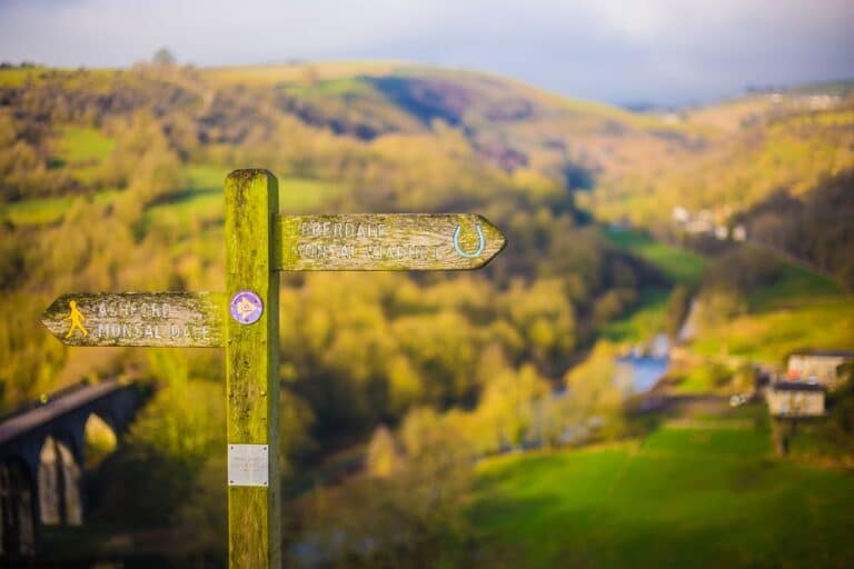
Illustrative photograph of a countryside path; the location has not been confirmed.
⭐️ Best for: Moorland and reservoir views
📍 Distance: 7.8 miles (about 12.6km) from Bishop’s Lane
This circular walk starts on Bishop’s Lane in Burbage, crosses the moorland towards Errwood Reservoir and returns to Bishop’s Lane. Allow extra distance to reach the start from central Buxton. Paths can be muddy after rain, so walking boots are recommended.
The walk starts and ends in Buxton. From Buxton station, allow around 40 minutes on foot to the start; the nearest large car park is at Pavilion Gardens, just over half a mile away.
The ruins of Errwood Hall are another attraction in the Goyt Valley. Check the map when planning a detour, as this adds distance to the walk.
The Heritage Way at Derwent Valley
Derwent Valley Heritage Way route

Deer on White Edge, near Baslow. Photo: Stephen Kidd / Unsplash.
⭐️ Best for: Reservoir views and water wildlife – look out for kingfishers
📍 Distance: About 55 miles; the Trust’s stage distances total 52.7 miles.
For those who are looking for a more strenuous challenge, the Derwent Valley Heritage Way offers an approximately 55-mile route through the county of Derbyshire.
The waymarked route starts at Ladybower Reservoir, passes Chatsworth and the Derwent Valley Mills World Heritage Site, and ends at Derwent Mouth near Shardlow, where the River Derwent joins the Trent. It can be walked in sections.
Manifold Valley: Wetton to Ilam circular walk

⭐️ Best for: Views across the Manifold Valley from Thor’s Cave
📍 Distance: 10 miles (16km); allow 3–5 hours
This circular walk from the stone built village of Wetton in the Peak District National Park, explores Thor’s Cave and then continues down to Ilam Park, before returning along the opposite side of the River Manifold. The approach to the cave is steep and can be slippery; entering it involves a slippery scramble in any weather. See the National Park’s visitor advice.
Shining Tor
A detailed map and directions are available to buy from the route author.
⭐️ Best for: Views over the Cheshire Plain
📍 Distance: 6.3 miles; allow around 3 hours
From Errwood Hall car park, the route climbs onto open moorland and follows the ridge towards Shining Tor. There are uphill sections and the paths can be muddy after rain.
The walk passes Foxlow Edge and The Street before reaching Shining Tor, with views across Cheshire and Derbyshire. It passes the ruins of Errwood Hall on the return. The access road has seasonal closures; check before travelling.
Kinder Downfall

⭐️ Best for: Kinder Downfall waterfall – spectacular if it’s frozen
📍Distance: 8 miles (12.8km), around 5–6 hours
The National Trust’s challenging circular walk from Hayfield climbs onto Kinder Scout via William Clough, passes Kinder Downfall and Kinder Low, and returns along an old packhorse route. Its written directions begin at Bowden Bridge: check the route map and allow for your journey to the start. Conditions on the exposed plateau can be much harder in winter.
Lantern Walk at Lyme Park

⭐️ Best for: Red deer in the park
📍 Distance: 1.7 miles, approx 1 hour 30 mins
Starting at Lyme’s main car park, this circular walk passes the house and climbs through Lantern Wood, with views towards the Peak District and Cheshire. You may see the park’s red deer. The National Trust grades it moderate, with stiles, steps and uneven ground.
Mam Tor Circular Walk

⭐️ Best for: Detouring to Castleton for a cup of tea
📍 Distance: 3 miles (4.8km), around 2 hours
Mam Tor’s summit has the remains of a prehistoric hillfort and burial mounds. Frequent landslips gave the hill its nickname, the Shivering Mountain, and eventually led to the old road below it being abandoned. The National Trust’s circular route begins at Mam Nick car park and climbs to views across the Edale Valley. It is graded moderate, with steps, steep climbs, gates and stiles; paths can be slippery after wet weather.
Lathkill Dale from Monyash
Lathkill Dale from Monyash route
⭐️ Best for: Limestone cliffs
📍 Distance: 4 miles (6.5km), around 2 hours 10 minutes
Starting in Monyash, this circular walk follows the Limestone Way past One Ash Grange Farm, descends into Cales Dale and returns through Lathkill Dale. Walking Britain grades it easy, though the descent into Cales Dale is steep. Its longer alternative also includes Bradford Dale.
Ilam to Dovedale

⭐️ Best for: A bit of everything
📍Distance: 1.5 miles (2.4km) one way, around 40 minutes
This National Trust trail leads from Ilam Park through Ilam village and fields to the stepping stones at Dovedale. The stated distance is one way, so allow extra time and distance for your return. It is graded moderate, with uneven slopes that can be muddy or slippery. The stepping stones can be impassable after heavy rain and may be slippery in icy weather.
Eyam and surrounding moorlands
⭐️ Best for: Moorland views and the Sir William Hill trig point
📍 Distance: 3.9 miles, approx 2.5 hours
This 3.9-mile circular walk starts near Sir William Hill Road and crosses Eyam Moor, with climbs and open views. Eyam village, its plague cottages and the church can be visited separately.
If you enjoyed our Peak District winter walks round-up, check out our guide to 25 of the best Peak District walks and hikes with more walks to explore.
Updated 23rd October 2026.
Advertisement
Advertisement