


This month’s guest blog post is from well-known local Peak District photographer Phil Sproson, who points out some of his favourite places to visit in the Peak District within a just 15 minute drive from Buxton.
The rugged gritstone hills, bleak moors, ancient woodlands and an engaging heritage means that the border between upland and lowland England is a truly absorbing area to discover. So, let us explore the Western Peak District.
This exploration deserves some time and the perfect base is Buxton. A stunning, architecturally-significant resort town, Buxton has so much to offer within its wood-fringed bounds. Apart from being a perfectly positioned town for getting to the Western Peaks, it is also a great location if you plan to see the East and Central parts of the Peak District too, with places like Castleton, Bakewell and Chatsworth being a 30 minute drive away.
First of all, we shall head out to the boundary of the Peak District, where Derbyshire gives way to the Cheshire Plains. Here we have the mill town of Bollington.
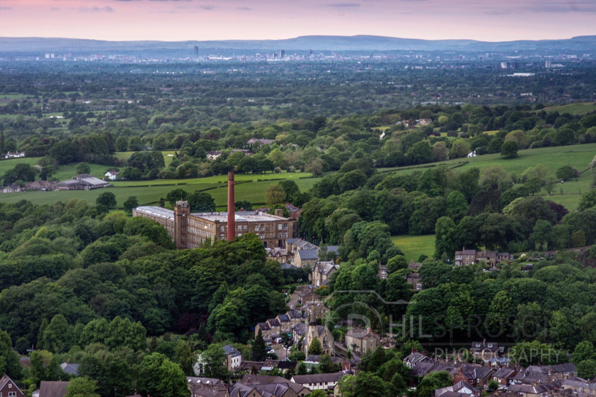
This is 25 to 30 minute drive from the centre of Buxton depending on your route; lets not rush, the countryside is beautiful. Bollington is wrapped around by the River Bollin and the Macclesfield Canal. It has vast old mills, a wealth of traditional pubs and gritstone houses that are all huddled up beneath Kerridge Ridge, topped by the impressive bee-hive looking monument called ‘White Nancy’.

This folly is a favourite focus for walkers, and it is a fantastic place to sit with a picnic on a summer’s day. The view from White Nancy is that of the Cheshire Plains and even the Welsh Hills on a good, clear day. It is also possible to trace the routes of aeroplanes going into and out of Manchester Airport. Walking up to the top of Kerridge Ridge is relatively easy with clean, clear paths with a little bit of a gradient to get up via steps. For easier walking, try the walk along the canal side through Bollington itself.
Moving South across the borders of the lowlands of the Cheshire Plains above Macclesfield you will find the uplands of Macclesfield Forest. This is a mountain-biker’s paradise with land that plunges from high moorland edges to the banks of the reservoirs within the forest fringe. Tracking further along you will find places like Windgather Rocks.
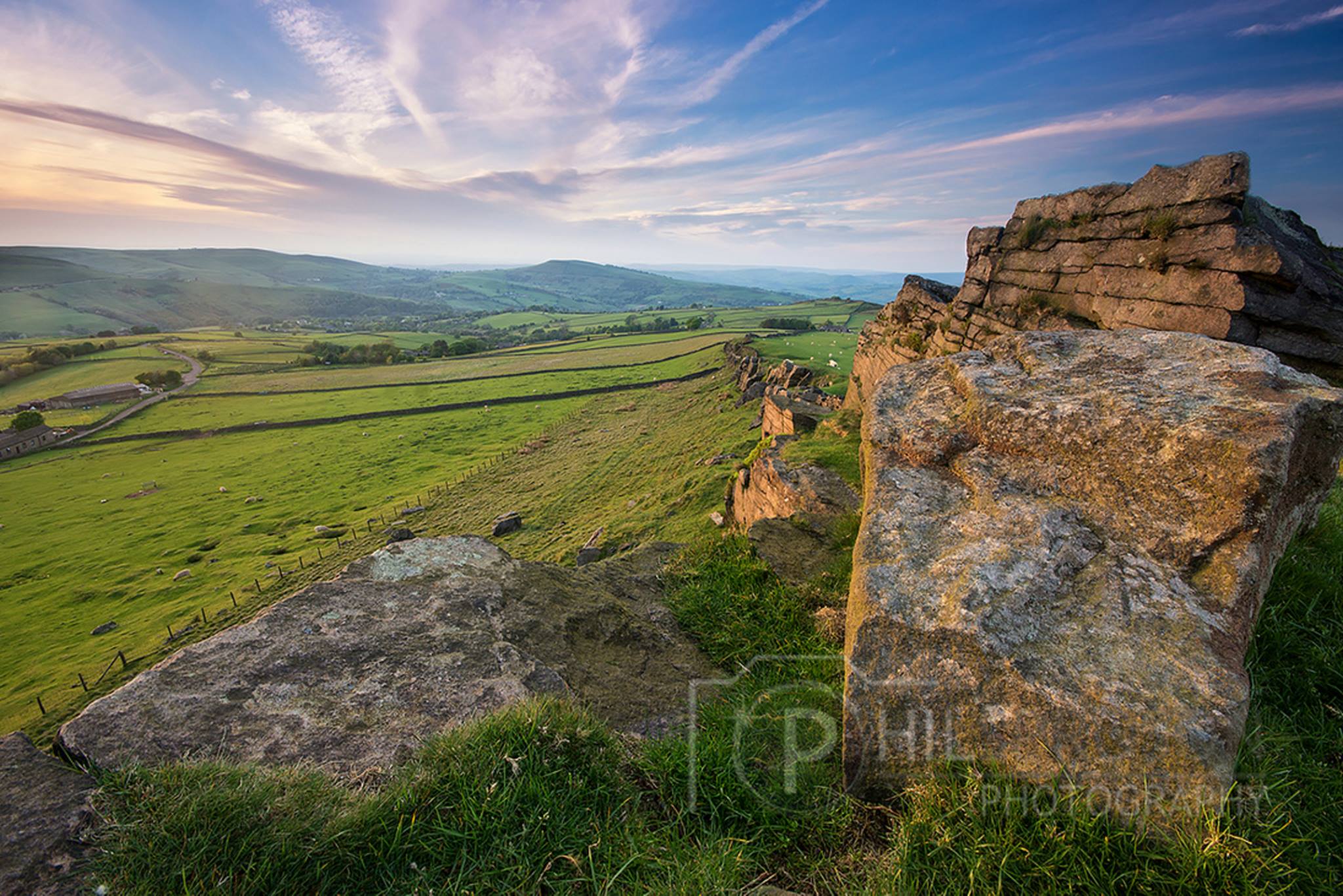
The Rocks are usually covered in climbers enjoying this open small edge. This is an easy roadside location and perfect again for picnics with an amazing vista of the rolling hills around Kettleshulme, Cheshire Plains and Manchester. On the top of the rocks you have a 360 degree view and looking East, it is possible to see the edges of Kinder Scout and Mam Tor in the distance.
Moving on via Pym’s Chair and a drive through the Goyt Valley, passing by Errwood Reservoir, I recommend following the gated road (if it is open) and keeping the reservoir on your left. Drive through the valley as it tightens and becomes a single track road heading towards Derbyshire Bridge which is below the Cat and Fiddle moor.
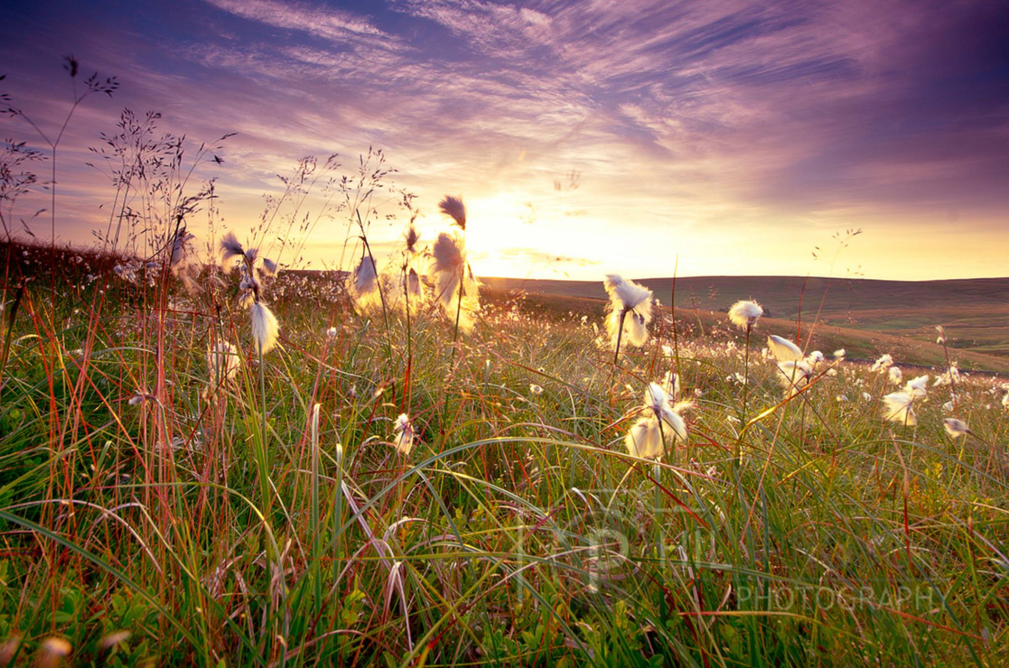
Perched on the bleak moorland between Macclesfield and Buxton, the famous Cat and Fiddle pub is the second highest inn in England (now closed). From the Cat and Fiddle pub you can walk to Shining Tor and take in the views of the infamous road that was once given the badge of being the most dangerous in Britain (not anymore since speed control measures were added to the route). The road is a beautiful ribbon that winds through the gentle hills with distant views of the Matterhorn of Cheshire, more commonly known as Shuttingsloe.

The road to the south of Buxton is different again; off the rolling A53 high road to Leek are some of the western Peaks’ most appealing tracts of countryside. There are narrow and adventurous lanes that head you away from the striking Axe Edge through to the quaint little Hollinsclough, the pretty Longnor and compact Earl Sterndale. Admire the sight of Parkhouse Hill and Chrome Hill which rise steeply with their jagged edges that give them the nickname of the ‘Dragons Back’.

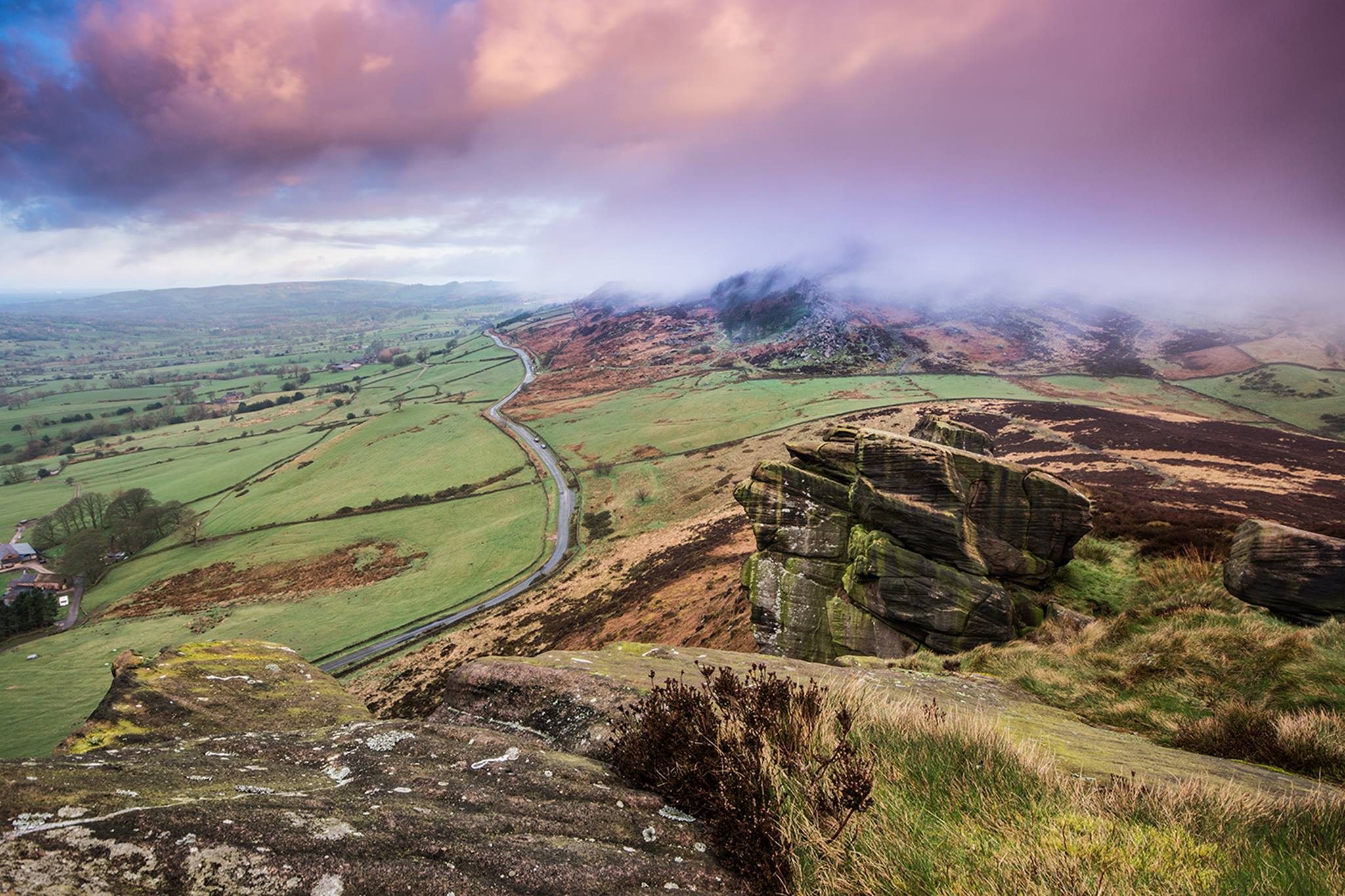
Further along the A53 towards Leek, the edges of the Staffordshire Moorlands come into view and culminate in the striking escarpment of The Roaches and Ramshaw Rocks. This is adventure land for every member of the family with outcrops of rock to climb and pine trees to wander through. The views from the ridge sweep deep into desolate moors, a wilderness of heather and deep cloughs and broken down walls. At the northern end of the Roaches and signed, paths drop steeply to the hidden abyss of Lud’s Church, a mysterious, ferny chasm secreted in thick oak woods and wreathed in legend.
Exploring these areas could be done in a week, you might be tired but I am sure you would feel accomplished and satisfied that you had made this journey and discovered lots. There is always the option to take it easier, discover even more and plan future visits to the area.
Phil is the creator behind the hugely successful Peak District Calendar, Buxton Calendar and soon to launch for 2017 the Matlock calendar; all featuring images he’s captured during the seasons across the area. Phil provides a range of professional photography services including holiday cottage photography, products, pets, family and individual portraits, landscape photography and special commissions on request.
To see more of Phil’s work and for further information, visit www.philsprosonphotography.com or his Facebook page or you can contact Phil on 07966. 509726.
Did You Enjoy This?
You might like our regular newsletter. We put all the best events, cultural highlights and offers from Buxton and the Peak District in your inbox every month.
This information will only be used to send you this newsletter. It is stored in Mailchimp.


